
5 parcours de vélo à découvrir cet été
Terrain varié, routes tranquilles et sentiers fluides : le Nord vous appelle.
Par Jennifer McCourt


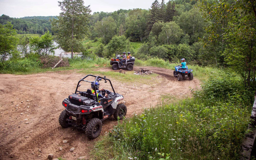

The Ontario Federation of All-Terrain Vehicles (OFATV) continues to grow, with the creation of several new ATV clubs in Ontario. The OFATV now has 18 member clubs, with several other irons in the fire just waiting to pop onto the Ontario ATVing landscape. The addition of new clubs means new trails and new members, while current clubs continue trail expansion and connectivity in their areas too.
So it should come as no surprise that a more diverse map tool for the OFATV trails was needed. The OFATV began a vigorous overhaul of our free online map to lay the ground work for creating something greater and more mobile. The overhaul meant that the online map was accessible from your smartphone’s web-browser and, using your phone’s GPS, was able to tell you where you were on the map. This was a great first step, leading to something even better: the upgrade of the free online map also allowed for on-the-go trail status to be determined, showing which OFATV trails were open/closed to always ensure you could “know before you go!”

With the overhaul of the online map done, for the remainder of the summer, volunteers and developers worked behind the scenes to go above and beyond the online map, leading to a big announcement in October.
After a few days of teasing, an announcement was made at the Toronto International Snowmobile ATV & Powersports Show, and the OFATV launched the QuadOn 2020 mobile map & navigation app for Android and IOS users. Five hundred apps sold in that first weekend!
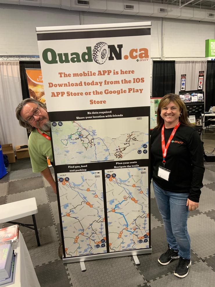
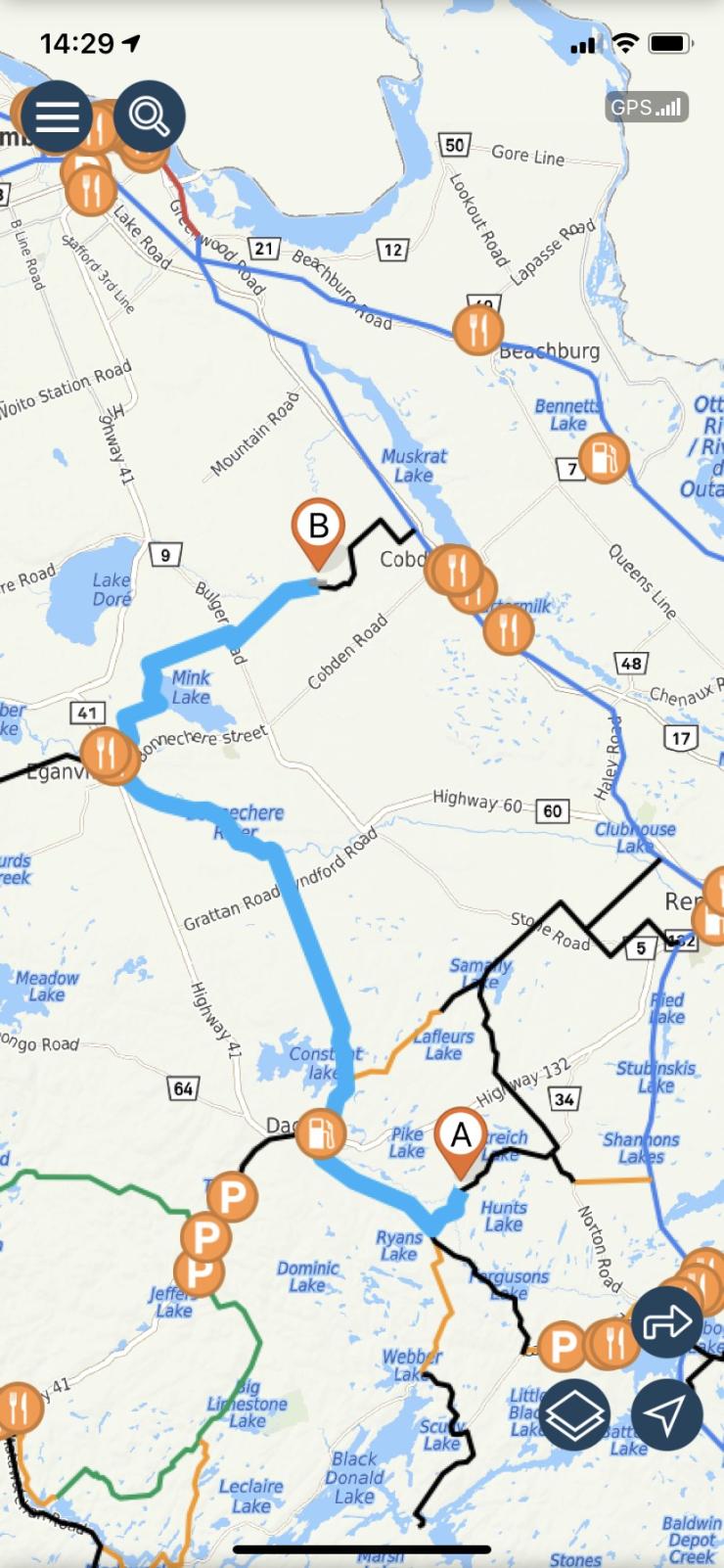
The QuadOn App brings an enhanced version of the free online web map to your pocket, making for a better riding experience than ever. Working both with and without cell coverage, you can enjoy the app’s functionalities no matter where you are on OFATV trails.
Additional enhancements from the free online map mean that you can:
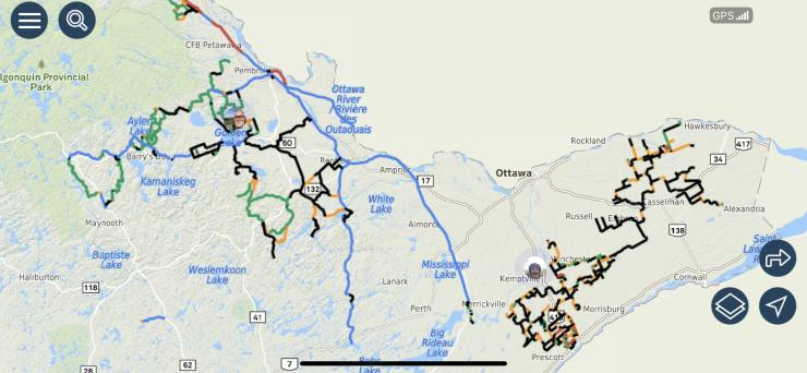
• Zoom in closer than ever before on the map
• Pick out zones you wish to download to have available while offline
• Select friends you’d like to share your location with, so you can see each other live on the map while out riding separately, together, or on either ends of a group
While on OFATV trails without cell coverage, you’re able to:
• See your location on the map through your phone’s GPS signal
• View nearby restaurants, gas stations, hotels, parking lots, and other services
• Access the trails condition as per the last data connection available
• See the distance between you and a specific point
While online (or in cell coverage), you’ll receive updates to trail status (closed/open) for the best riding experience, and can easily meet with friends by sharing your position with each other, as well as plan out routes and itineraries to share with your group.
The QuadOn app is a great bang for your buck. For the cost of two large coffees per year, you can keep the trails at your fingertips on your mobile device! A mobile app is not everyone’s cup of tea (pun intended); it is a low-impact method to get trails into people’s hands without the investment of a GPS unit, GPS map chip, or carrying a paper map. Those uninterested in a mobile app can rest assured, the regular methods of navigating the trails still exist—paper maps from your local club, signage on the trails, and OFATV trails are available for purchase for your Garmin GPS Unit from Backroads MapBooks.
Regardless of what you use to navigate the OFATV trails, get out there and ride, ’cause my worst day of ATVing is still better than my best day of work!


